SOCIAL STUDIES-

20th Century America
American Experience
American Revolution
Colonial America
Founding Fathers
Ancient Civilizations
Anc. African Civilizations
anthropology
Asian Americans
aviation
banned books/authors
Bill of Rights
Black History
US Civil War
Voices of Diversity
notable educators
explorers
flags
geography
Great Thinker Quotes
Heroes Science & Tech
Heroes from History
notable historians
Historic Days
historic documents
Historic Headlines
Historic Heroes
history of art
History Through Lens
History Through Literature
Holocaust
Images of Labor
Inventions Changed World
Latinos
maps
Middle Ages
money/currency
Nation of Immigrants
Native Americans
Olympics
peace & justice
philosophers
Political Leaders- US
Political Process
presidents
Stonehenge
Supreme Court
Supreme Court Justices
Technology's Past
Vietnam Era
world leaders
world's religions
World War I
World War II
This Day in History


Africa
Asia
Australia
Europe
Middle East
Central America
North America
South America
---------
oceanography
star charts


MAP CALENDARS

Antique Maps Calendars


BOOKS ABOUT MAPS & MAPMAKING

Mercator
Mercator


Be Expert with Map and Compass
Be Expert with
Map and Compass


Orienteering
Orienteering


You Are Here
You Are Here


The Map That Changed the World
The Map
That Changed
the World:
William Smith
and the Birth of Modern Geology


Longitude
Longitude:
The True Story
of a Lone Genius
Who Solved the Greatest Scientific Problem of
His Time


1421: The Year China Discovered America
1421:
The Year China Discoverd America


The Riddle of the Compass
The Riddle
of
the Compass:
The Invention That Changed the World


The Measure of All Things
The Measure
of All Things:
The Seven-Year Odyssey and Hidden Error
that Transformed
the World


Teacher's Best - The Creative Process


Maps Educational Posters & Charts, pg 2 of 5
Educational map posters and charts as teaching resources for the classroom and home schoolers.


social studies > maps 1 | MAPS & CHARTS pg 2 | 3 | 4 | US maps | NG Maps | ocean maps < geography


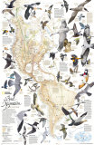
Bird Migration Map, Art Print
Bird Migration Map,
Art Print


Bird Migration Map

This National Geographic classic shows the mystery of bird migration and the incredible journeys that birds undertake in the Americas each year with sixty-seven full illustrations. It is printed at a scale of 1 inch to every 315 miles.

• more bird posters


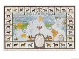
Horse Map of the World Showing Different Breeds, Giclee Print

Horse Map of the World

• more horses posters


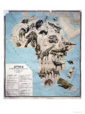
Map of Animals in Africa, Giclee Print
Map of Animals
in Africa,
Giclee Print

Map of Animals in Africa

• more Africa posters


World Map Stencil
World Map Stencil

World Map Stencil
Create a massive World map using Ursa Major's World Map Stencil. This easy to use product allows you to create a huge world mural measuring 36' wide by 18' tall. Ideally suited for schools, this product comes in an eight section stencil with holes that define detailed borders of the continents, countries, oceans, and the largest lakes of the world. Playground tested, the photo illustrates a map painted by four adults and ten 2nd - 4th graders in three hours. Product includes instructions. Scale: 1 meter = 4000 km

This great product encourages educational classroom projects such as:
• Geographical - paint rivers, mountains, lakes, and deserts
• Political - show major cities, capitals • Economic - find dams, major crops, products and resources • Scientific - locate species habitats and animal/bird migration routes
• Historical - draw explorer routes, places of historical interest, and historical political borders


The Global Puzzle
The Global Puzzle

The Global Puzzle
Did you know that the average individual knows where only 18 of the world's 193 countries are located? THE GLOBAL PUZZLE is a new way to learn the countries of the world where the pieces are actually shaped like individual countries.


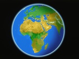
Satellite Map of Africa poster

Satellite Map of Africa

satellite posters
continent posters
Africa posters


Stonehenge Map
Stonehenge Map

Stonehenge Map

• more Stonehenge posters


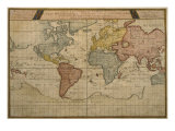
Map Showing the World Trade Shipping Routes, Cartography by Pierre Duval, Giclee Print

Shipping Maps


previous page | top
Maps pg 1 | 2 | 3 | 4 | US maps | NG Maps | ocean maps | Lewis & Clark |

I have searched the web for visual, text, and manipulative curriculum support materials - teaching posters, art prints, maps, charts, calendars, books and educational toys featuring famous people, places and events - to help teachers optimize their valuable time and budget.

Browsing the subject areas at NetPosterWorks.com is a learning experience where educators can plan context rich environments while comparing prices, special discounts, framing options and shipping from educational resources.

Thank you for starting your search for inspirational, motivational, and educational posters and learning materials at NetPosterWorks.com. If you need help please contact us.


NPW home | Global PathMarker Collection | APWTW Blog | faqs-about | contact | search | privacy
links for learning & curriculum ideas | bookshelves | toybox | media | ecards | quotes

NetPosterWorks.com ©2007-2015 The Creative Process, LLC All Rights Reserved.

last updated 12/25/13