|
|
Asia and Asian Cultures Posters, Prints, Charts, Maps
for social studies classrooms and homeschoolers
|
geography > ASIA & ASIAN CULTURES < social studies
|
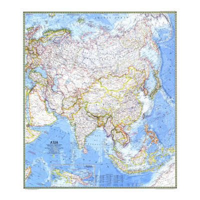
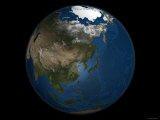
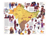
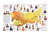
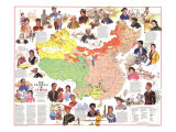
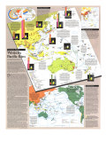
Asia, the largest continent on Earth, is defined by subtracting Europe and Africa from the great land mass of Africa-Eurasia. The exact boundaries are vague: Asia and Africa meet somewhere near the Suez Canal, the boundary between Asia and Europe runs via the Dardanelles, the Sea of Marmara, the Bosphorus, the Black Sea, the ridges of the Caucasus or through the Kuma-Manych Depression, the Caspian Sea, the Ural River or the Emba River and the Ural Mountains to Novaya Zemlya. About 60% of the world's population live in Asia. The region of Asia also includes nearby islands in the Indian and Pacific Oceans.
|
|
|
|
|
|
|
|
|
|
|
|

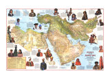
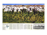
America: A Nation of Immigrants: South Asia and the Middle East poster
no longer available
|
South Asia and the Middle East-
...
Some immigrants from Iraq, Palestine, and other countries did find jobs on farms and in factories here. A large number settled in Detroit to work in the automobile industry. In the 1960s and '70s, Iran experienced a "brain drain" when thousands of Iranian students and professionals took up permanent residence in the United States. Iranians immigrated for better jobs and education, and to escape political turmoil. Most of the immigrants from Turkey were Armenians who came to America to escape horrible conditions in their native land. Some were professionals or merchants, but in the United States, most had to start as unskilled laborers. Later, they opened shops and restaurants.
In the early 1900s, a drought in the Punjab region in India hurt many farm families. Some Indian families then sent their sons to America to earn mony to send back home. In America, some of these East Indian immigrants became successful farmers and business owners. When U.S. immigration restrictions were relaxed in 1965, many highly trained Indians and their families came to America. The new law also opened the door to immigrants from Pakistan, Bangladesh, and Sri Lanka. In America, some East Indians have worked hard to retain their culture. Sikh Indians still wear distinctive turbans. Young East Indian girls attend schools where they learn traditional dances. And East Indians philosophy, music – which features the sitar and the tabla – and religions principles of nonviolence have made their way into American culture.
• Middle East posters
• A Nation of Immigrants posters
|
|
|
Azerbaijan
|
|
previous page | top
|
|
I have searched the web for visual, text, and manipulative curriculum support materials - teaching posters, art prints, maps, charts, calendars, books and educational toys featuring famous people, places and events - to help teachers optimize their valuable time and budget.
Browsing the subject areas at NetPosterWorks.com is a learning experience where educators can plan context rich environments while comparing prices, special discounts, framing options and shipping from educational resources.
Thank you for starting your search for inspirational, motivational, and educational posters and learning materials at NetPosterWorks.com. If you need help please contact us.
|
|
|