|
|
|
|
|
|
|
|
|
|
|
|
GEOGRAPHY TEACHING RESOURCES
|
|
|
|
|
|
|
|
|
|
|
|
|
|
|
|
|
|
|
|
|
|
|
|
|
|
|
|
|
|
|
|
|
|
|
|
|
 |
|
|
|
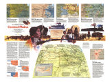
Central Plains States Poster Map - Making of America, 1985, side 1
for the geography and social studies classrooms and home schoolers.
|
geography > North America > United States > Midwest States > CENTRAL PLAINS MAP 1 | 2 < history < social studies < maps
|
The 1985 Central Plains map Side 1 features:
• An abundance of historical notes
• Historical trail markers, ghost towns, battlefields, mining areas, and sites
• National parks
• Capitals, cities, and towns
• Mountains, rivers, lakes, and swamps
• Interstate highways, major roads, roads, trails, passenger railroad, and scheduled air service
• Elevations in meters
|
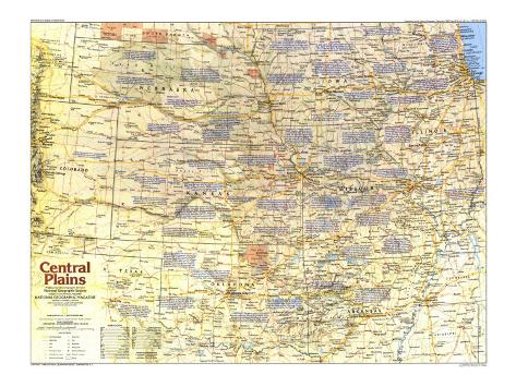
Central Plains Poster Map,
National Geographic, 1985, side 1
Nebraska, Iowa, Illinois, Missouri, Kansas, Oklahoma,
Arkansas, eastern Colorado, eastern Wyoming
|
|
* Lesson plan idea - have your students update the information and latest statistics concerning the Central Plains states; discuss, contrast and compare the political, economic, and environmental situations the region is dealing with currently. • maps
In 1803 the U.S. Army built Fort Dearborn to guard the portage between the Chicago and Des Plaines Rivers. Chicago contained 300,000 people by 1871, the year of the big fire. By 1900 railroads had made it the world's largest grain market and meat-packing center. Described as “Freight Handler to the Nation” by Carl Sandburg. Hub of the mid-continent's airways.
A DeKalb farmer, J.F. Glidden, is credited with inventing barbed wire in 1874. Within a decade this cheap, effective fencing was closing off the open-range cattle industry. By protecting against roving herds, barbed wire helped homesteaders expand farming onto the treeless plains.
In 1839 Mormon leader Joseph Smith platted Nauvoo as a refuge from persecution in Missouri; it quicly became the state's second largest city, after Chicago. Smith's murdr in 1844 triggered as exodus to Utah, and French Icarians moved in. Their communistic colony soon fell apart, but German immigrants followed.
St. Louis - This headquarters of the western fur trade and gateway west for trappers, explorers, and settlers was founded in 1764 by French traders. The leading U.S. river port during the steamboat era, it was surpassed only by Chicago as a railroad center. Missouri's largest metropolis counts 2.4 million people. (1985 number.)
|
|
|
|
|
previous page | top
geography > North America > United States > Midwest States > CENTRAL PLAINS MAP 1 | 2 < history < social studies < maps
|
|
I have searched the web for visual, text, and manipulative curriculum support materials - teaching posters, art prints, maps, charts, calendars, books and educational toys featuring famous people, places and events - to help teachers optimize their valuable time and budget.
Browsing the subject areas at NetPosterWorks.com is a learning experience where educators can plan context rich environments while comparing prices, special discounts, framing options and shipping from educational resources.
Thank you for starting your search for inspirational, motivational, and educational posters and learning materials at NetPosterWorks.com. If you need help please contact us.
|
|
|