GEOGRAPHY INDEX
................

Africa
Antarctica
Asia
Australia
Caribbean/West Indies
Central America
Cities
Europe
Explorers
Geographers
Landforms -
bays, gulfs, headlands
biomes
continents
deserts
Earth from Space
islands
isthmus & straits
lakes
mesa, plateau, butte
monolith
mountains
oceans & seas
river & stream
volcanoes
wetlands
Maps
Middle East
National Parks
North America
South America


CALENDAR

Rocky Mountains Calendars


GEOGRAPHY TEACHING RESOURCES

The Rugged Rockies
The Rugged
Rockies


Teacher's Best - The Creative Process


Above the Rockies Poster Map, 1995
for the geography and social studies classrooms and home schoolers.


geography > North America > mountains > ABOVE THE ROCKIES MAP < history < social studies < maps


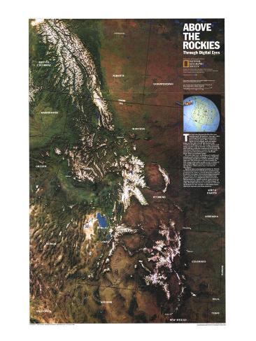
The 1995 Above the Rockies map features:
• A digitally-enhanced satellite image of the region
• State boundaries and major cities
• Information about the making of this map

Above the Rockies Poster Map, 1995

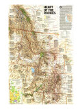
Heart of the Rockies Poster Map, 1995


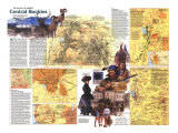
Central Rockies Poster Map, 1984


* Lesson plan idea - illustrate tectonics; set up gallery of Rocky Mountain views; • maps


The land that became the Rockies was transformed 100 million years ago when a drifting North America rammed a dense oceanic plate. The continent's lighter crust bulged, and mountains began to rise. Just west of the Rockies the wrinkled-looking terrain of younger basin-and-range country was formed by crustal stretching and faulting, while the continent's drift over the stationary Yellowstone volcanic hot spot left a smooth, curved track that is now the Snake River Plain in southern Idaho.

To create this view, techniques of tradition mapping and satellite imaging were combined. Instruments on NOAA weather satellites orbiting some 520 miles above Earth recorded the four images that make up this scene in infrared and visible light on virtually cloudless early spring days, when snow cover was near its maximun. Satellite data were digitally plotted by World-Sat International of Canada on a standard map projection in order to cancel distortion induced by Earth's curvature. For a three-dimensional effect, contour lines from corresponding topographic maps were digitied and converted to terrain features. Added realism comes from assigning natural colors to the satellite image. Finally, WorldSat directed a computer to select an inclination for the sun that should make mountains and canyons cast deep shadows.

Himalaya Poster Map
perspective posters


previous page | top
geography > North America > mountains > ABOVE THE ROCKIES MAP < history < social studies < maps


I have searched the web for visual, text, and manipulative curriculum support materials - teaching posters, art prints, maps, charts, calendars, books and educational toys featuring famous people, places and events - to help teachers optimize their valuable time and budget.

Browsing the subject areas at NetPosterWorks.com is a learning experience where educators can plan context rich environments while comparing prices, special discounts, framing options and shipping from educational resources.

Thank you for starting your search for inspirational, motivational, and educational posters and learning materials at NetPosterWorks.com. If you need help please contact us.


NPW home | Global PathMarker Collection | APWTW Blog | faqs-about | contact | search | privacy
links for learning & curriculum ideas | bookshelves | toybox | media | ecards | quotes

NetPosterWorks.com ©2007-2015 The Creative Process, LLC All Rights Reserved.

last updated 12/25/13

The Creative Process Educational Poster Directory at NetPosterWorks features visual instructional
materials and resources, integrating content and design for learning across disciplines.