|
|
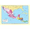
Honduras and Honduran Culture Posters, Prints, Charts, & Maps
for social studies classrooms, home schoolers, offices.
|
|
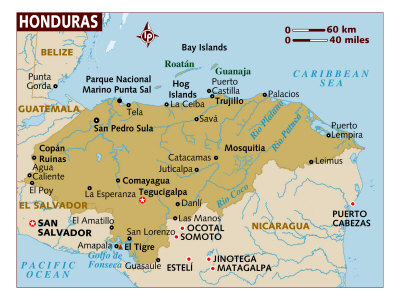
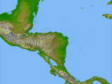
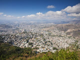
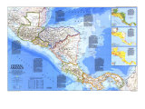
The Republic of Honduras, located in Central America, has a mountaineous interior with narrow coastal plains on the northern Caribbean coast between Guatemala and Nicaragua (La Mosquitia), and on the Gulf of Fonseca on North Pacific Ocean between El Salvador and Nicaragua. Belize (formerly British Honduras) is across the Gulf of Honduras, to the north. Columbus called the land “Honduras” in reference to the deep water off the coast.
The climate of Honduras is sub-tropical in the lowlands and temperate in the mountains. Like other Central American countries Honduras is susceptible to hurricanes (notable Fifi in 1974 and Mitch in 1998) and earthquakes.
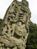
Copán, in extreme western Honduras, was the site of a major Classic era Mayan kingdom that had disappeared by the time the Columbus landed near Trujillo in 1502.
After independence from Spain in 1821, Honduras was a member of the United States of Central America federation that was destroyed by civil war. Honduras is a democratic constitutional republic with compulsory and universal suffrage at 18 years of age. The capital of Honduras is Tegucigalpa.
|
|
|
|
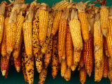
Honduras - A sanctuary for political refugees from Nicaragua and El Salvador, Honduras is the poorest of Central America's nations. It maintains strong ties with the U.S., and American firms own most of the lowland banana plantations, although the industry is over seen by the government. Development is slow, with communication and a unified sense of nationhood hampered by the mountainous geography. Lack of recent volcanic activity has deprived the land of the enriching ash that nourishes crops in neighboring countries. The regions tallest dam bridges the Humuya River and is expected to meet a third of the country's need for electricity. (Text and statistics as of 1986.)
|
|
|
|
|
|
|
|
|
|
|
|
|
The Maya
(500 B.C. – 900 A.D.)
The Maya Indians built one of the world's most remarkable civilizations in the jungles of Central America. Like the ancient Greeks, who civilization was nearing its peak just as the Maya appeared, the Maya are known for their fabulous temples, and for their amazing knowledge of math and science. The Maya were the only Indians in America to develop a written language. Today, people come from all over the world to view the crumbling ruins of their once-great cities. ... • more Ancient Civilizations posters
Artwork depicts the Temple of the Inscriptions at Palenque, statue of the Maya leader Lord Pacal, and the Mayan calendar.
• more Maya posters
• Your Travel Guide to Ancient Mayan Civilization
|
|
|
|
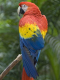
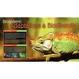
Biosphere: Adaptations & Biodiversity
Poster Text: An adaption is a change in the structure or function of an organism which allows it to thrive within its environment. It may take physical adaptation such as the size or shape of the organism or it way in whch its body works. It may also be a change in an animals behavior. Adaptation is produced through the process of natural selection. As the environment changes, organisms that cannot adapt eventually die. Individuals with the ability to adapt produce more successful offspring. These offspring may carry the adaption forward until the whole species contains organisms which are adapted to the new environment.
An organism's environment consists of many important element whcih can influence adaption. Whether the climate is hot, cold, dry or wet will have an effect on all creatures that live in that environment. The presence of predators will also have an effect. Prey animals must learn to defend themselves or become adept at escaping predators.
• more Eco-sphere posters
• Biodiversity in Belize
|
|
|
previous page | top
|
|
I have searched the web for visual, text, and manipulative curriculum support materials - teaching posters, art prints, maps, charts, calendars, books and educational toys featuring famous people, places and events - to help teachers optimize their valuable time and budget.
Browsing the subject areas at NetPosterWorks.com is a learning experience where educators can plan context rich environments while comparing prices, special discounts, framing options and shipping from educational resources.
Thank you for starting your search for inspirational, motivational, and educational posters and learning materials at NetPosterWorks.com. If you need help please contact us.
|
|
|
|