|
|
Nicaragua Posters, Art Prints, Charts, & Maps
for social studies classrooms, home schoolers, offices.
|
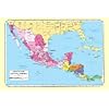
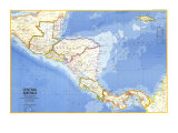
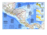
geography > North America > Central America > NICARAGUA < Hispanics and Latinos < social studies
|
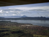
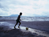
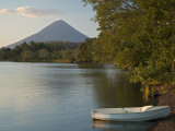
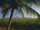
The Republic of Nicaragua, the largest nation in Central America, is bordered by Costa Rica on the south and Honduras on the north. El Salvador is just across the Gulf of Fonseaca to the northwest on the Pacific Ocean coastline. The east coast is the Caribbean Sea. The largest freshwater lake in Central America is Lago de Nicaragua. The Pacific and Atlanta Lowlands have a tropical climate, the north-central mountains are cooler. Like other Central American countries Nicaragua is susceptible to hurricanes; and western Nicaragua, sitting atop the collison point of two tectonic plate is subject to volcanic eruptions and earthquakes.
Nicaragua was colonized by the Spanish in the early 1500s, won independence from Spain in 1821 and was a member of the United States of Central America federation until 1838 when it became an independent republic. Nicaragua was the first nation to rarify the UN Charter after WWII. The capital of Nicaragua is Managua. Nicaragua suffered a civil war in the 1980s between the Sandinistas and the Contras.
Nicaragua is a blended word from the Spanish “agua” for water and the word they used for the indigenous tribe that inhabited the area.
|
|
|
|
Nicaragua - Largest of the Central American countries, Nicaragua has been plagued since its founding by political unrest. When civil war broke out in 1978, Marxists pledged to abolish the social and economic barriers that divided the country. Land reforms were enacted, but continued violence and the nationalization of industries crippled the economy and led to a vast exodus of refugees. At the mercy of earthquakes and active volcanoes, Nicaragua's relatively small population is concentrated in areas of rich volcanic soil surrounding the lakes near the Pacific coast. The capital, Managua, has been leveled twice in this century by earthquakes. (Text and statistics as of 1986.)
|
|
|
|
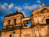
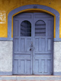
Managua, located on the southern shores of Lake Managua, is the capital city of Nicaragua. The name Managua originates from the term Mana-ahuac, from the indigenous Nahuatl language, translates to “adjacent to the water” or site “surrounded by water”.
Managua is situated on a fault line and has experienced many earthquakes.
|
|
|
|
|
|
|
|
|
|
Isla de Ometepe in Lake Nicaragua is the largest fresh-water volcanic island in the world.
|
|
|
|
|
|
|
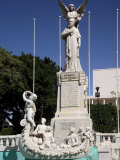
Rubén Darío
b. 1-18-1867; Metapa (today Ciudad Dario), Nicaragua
d. 2-6-1916; Leon, Nicaragua
Nicaraguan poet Rubén Darío initiated the Spanish-American literary movement known as modernismo (modernism) that flourished at the end of the 19th century. Darío was widely travelled in Central and South America, and Europe.
Rubén Darío quotes ~
• “Sweet as sweetest Grecian honey will my song be when I sing, O Beloved, in the season of the Spring!”
• Ruben Dario at Amazon.com
|
|
|
|
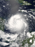
Hurricane Felix, category 5, struck Central America between Nicaragua and Honduras on September 4, 2007. Felix caused 133 deaths and $50 million of damage. FYI - the area between Nicaragua and Honduras is known as the Mosquito Coast; Columbus explored there in 1504.
• hurricane posters
|
|
|
|
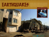
Earthquakes
Poster Text: When the plates of the Earth's crust move and collide with each other the forces create vibrations. These vibrations are commonly known as earthquakes. ... most occur along plate boundaries where techonic forces build up. ... more
|
|
|
previous page | top
|
|
I have searched the web for visual, text, and manipulative curriculum support materials - teaching posters, art prints, maps, charts, calendars, books and educational toys featuring famous people, places and events - to help teachers optimize their valuable time and budget.
Browsing the subject areas at NetPosterWorks.com is a learning experience where educators can plan context rich environments while comparing prices, special discounts, framing options and shipping from educational resources.
Thank you for starting your search for inspirational, motivational, and educational posters and learning materials at NetPosterWorks.com. If you need help please contact us.
|
|
|
|