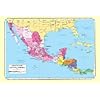
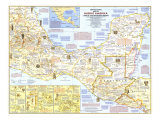
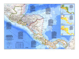
However Central America is defined, few could deny that it is one of the most complex regions on Earth, and one ever in the process of disquieting change.
1 - BEFORE 1500 - PRE-COLUMBIAN GLORY -
WITH AGRICULTURE firmly established by A.D. 1, various cultures rose, flourished, and declined in Central America over the next 15 centuries.
In the north the Lowland Maya created one of Mesoamerica's most brilliant civilizations. Their city-states, centered on Tikal, Copan and other dazzling capitals, served as seats of dynasties and settings for monumental works of art and architecture.
Among the farming villages southeast of Mesoamerican frontier, powerful tribal leaders gradually rose to power. Archaeological remains from Honduras through Panama provide glimpses of separate but similar chiefdoms sustained by farming, fishing and hunting. By 500, a far-reaching trade in shell, feathers, salt, and other resources had fostered a burgeoning of both population and prosperity–and the rise of superb craftsmanship, one of Central America's hallmarks. Jadeite and other semiprecious stones were carved into mythical birds and animals. Gold and gold-alloy jewelry became another medium of sacred art and a symbol of status among the nobility, as did masterpieces of polychrome pottery in distinctive styles and shapes.
2 - 1500-1821 - CONQUESTS AND COLONIES -
SPAIN IN 1500, vibrant with religious zeal and political unity after the expulsion of the last of its Moorish invaders, turned eagerly to the New World in quest of gold, souls, and land.
Two decades later, mainland footholds–by Cortes in Mexico and Balboa in Panama – followed earlier Spanish forays along the coast. Each served as a base for waves of conquest concentrated on the vast land in between. From the north Alvarado cut a bloody swath through highland Guatemala, defeating he Quiche Maya chieftain Tecum near present-day Quezaltenango and effectively ending resistance. Cordoba and others moved north from Panama, and by mid-century subjugation was complete.
In late colonial times, Spanish administrative boundaries divided by the conquered land between the Captaincy Genreal of Guatemala–itself part of the Viceroyalty of New Spain– and Viceroyalty of New Granada. The division underlay the basic cultural and historical contrast that still obtains between Panama and the rest of Central America.
While Spanish towns, missions, mines, and haciendas grew rich in the most populous areas of the interior, the English and their black slaves established centers for logwood and other exports along desolate stretches of the east coast.
3 - 1821-1900 - TIME OF INDEPENDENCE -
POLITICAL INDEPENDENCE crept quietly into Central America in 1821, transforming colonial provices into five fledgling nations–Guatemala, Honduras, El Salvvador, Nicaragua, and Costa Rica. (Chiapas, formerly part of Guatemala, joined Mexico.) The five formed a feeration in 1823 but fragemented amid civil wars that pitted Honduran Francisco Morazan, laeding light of unification, against Jose Rafael Carrera, the Guatemalan separatist. Later Carrera set the boundaris of Belize, which became the colony of British Honduras in 1862.
Central Americ's true revolution lay not in politics but in coffee. Introduced from Cuba in the 1700s, the crop thrived on the volcanic slopes and became the region's primary export. Bananas later took hold in the coastal lowlands. Largely under foreign control, the legendary plantations stereotyped the whole area, giving rise to its most disparaging political epithet–“banana republic.”
In the mid-1800s the California gold rush stimulated the search for a crossing between oceans. Precursor of the great canal, the Panama Railroad was completed in 1855.
4 - 1900-1945 - PRELUDE TO CHANGE -
COLOSSAL GAPS between rich and poor, an outdated economic structure, and politics plagued by petty competition, corruption, and pervasive foreign interests sowed the seeds of social discord in Central America. The last battlefield effort to unify the nations had died with Guatemala's liberal President Justo Rufino Barrios in 1885.
Malaria, yellow fever, and inadequate equipment doomed French efforts to complete an interoceanic canal in Panama begun in 1881. The United States, recognizing its strategic importance, manipulated Panama's independence from Colombia in 1903, solved the problems of epidemic and engineering, and completed the canal a decade later. Panama grated the U.S. jurisdiction over the Canal Zone.
Prior to World War II the U.S. increased dollar investments–mainly in bananas–and intervened militarily to protect capital and bolster friendly governments. These forces vied with opposing social or nationalistic movements as extolled in the poetry of Ruben Dario and others. Sporadic revolts, such as that lead by Augusto Cesar Sandino in Nicaragua, though short-lived and followed by repression, often provided martyrs for the cause of social justice.
5 - 1945-PRESENT - UPHEAVAL UNCERTAINTY -
COMPLETION in the 1970s of the Pan American Highway–except for the section in Panama's Darien Gap–provided a reliable land link between Central American nations Since then, interregional and international air service has helped solve shortcomings in communication. Yet differing national profiles and problems prevail.
Efforts to stabilize theregional economy led to the establishment of the Central American common Market in 1960. But within the decade it crumbled, following the border conflict between Hondurs and El Salvador. In 1977 the United States acknowlegd Panama's right to sovereignty and eventual ownership of the canal. Two years later Nicaragua's Sandinista revolution overthrew the corrupt Somoza regime. Politicians in El salvador and Guatemala compete with powerful military factions or with opponents on the philosophical right or left. Violence in much of the region ranges from clandestine death squads to outright civil war, the upheavals have fostered vast movements of refugees seeking sanctuary in Mexico or the United States. Today Central America, a land of global strategic import, remains one of diversity and unfathomable destiny.